EN
EN
Core technology highlights
The monitoring system has the function of real-time monitoring of the drone’s position, altitude, speed and track. The drone is equipped with necessary sensors and communication equipment to transmit real-time data to the monitoring system so that supervisors can track and monitor it.
User-friendly operation interface
Intuitive graphical user interface simplifies operation process and improves user experience.
Powerful data processing capabilities
Analyze flight data in real time, optimize flight paths, and improve mission execution efficiency.
Intelligent monitoring and early warning system
Monitor the status of drones in real time, warn of potential risks in advance.
Comprehensive communication links
Supports multiple communication protocols to ensure a stable connection between the drone and the ground control center.
Modular hardware architecture
Easy to upgrade and maintain, adapt to different mission requirements, and create intelligent flight.
Advanced flight control system
It integrates the latest navigation algorithms and automatic obstacle avoidance technology.
Electronic fencing and identification
Regulatory systems can establish electronic fences to limit the flight range of drones.
Flight planning and permit management
Easy to upgrade and maintain, adapt to different mission requirements.
Airspace resources and flight management
Realize the full life cycle management of drones including registration, insurance, and so on.
Both hardware and software products are available
Modular hardware and software architecture, easy to upgrade and maintain, adapt to different mission requirements
Remote identification management software (Android)

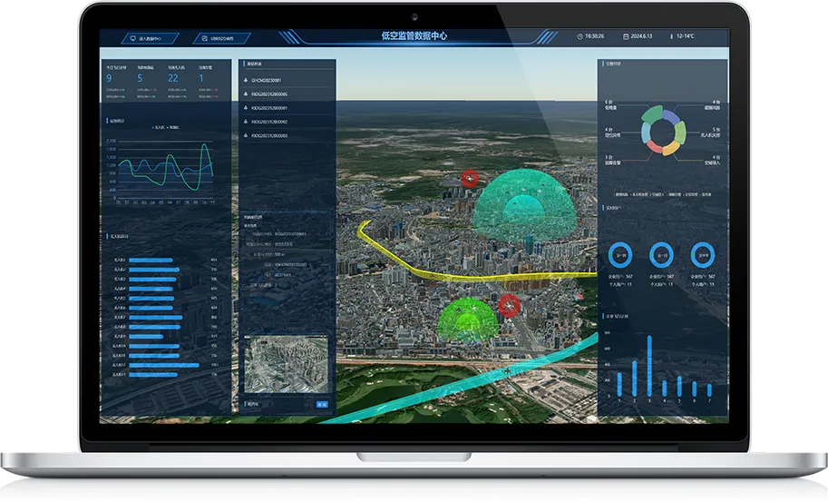
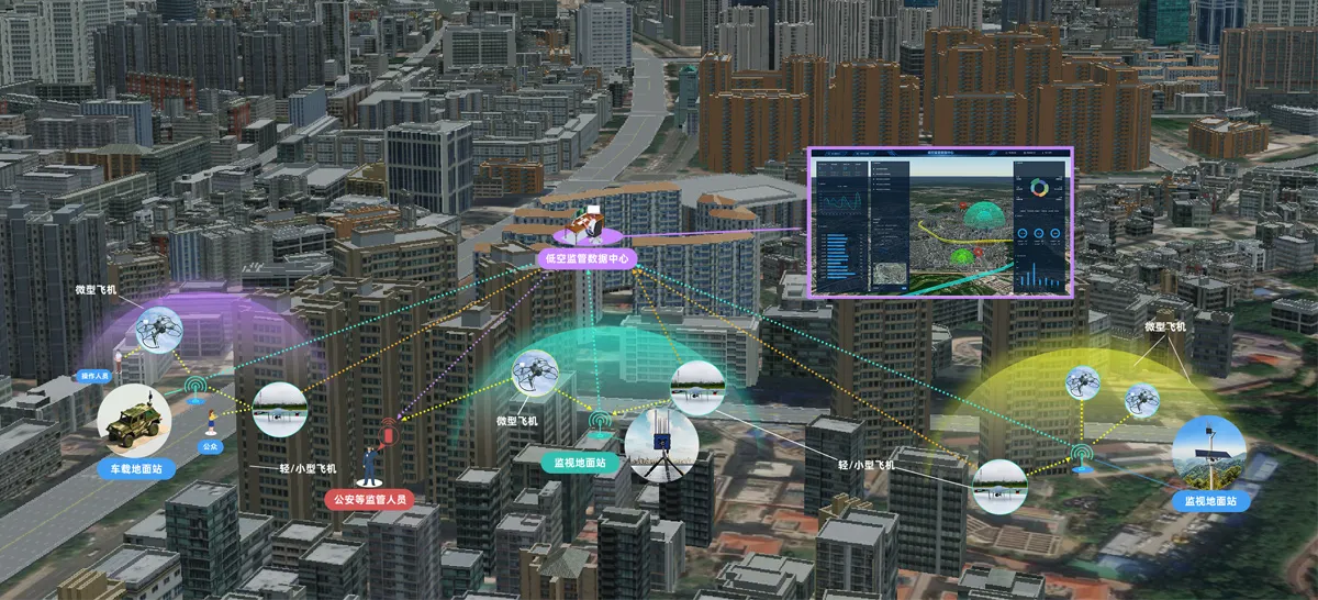
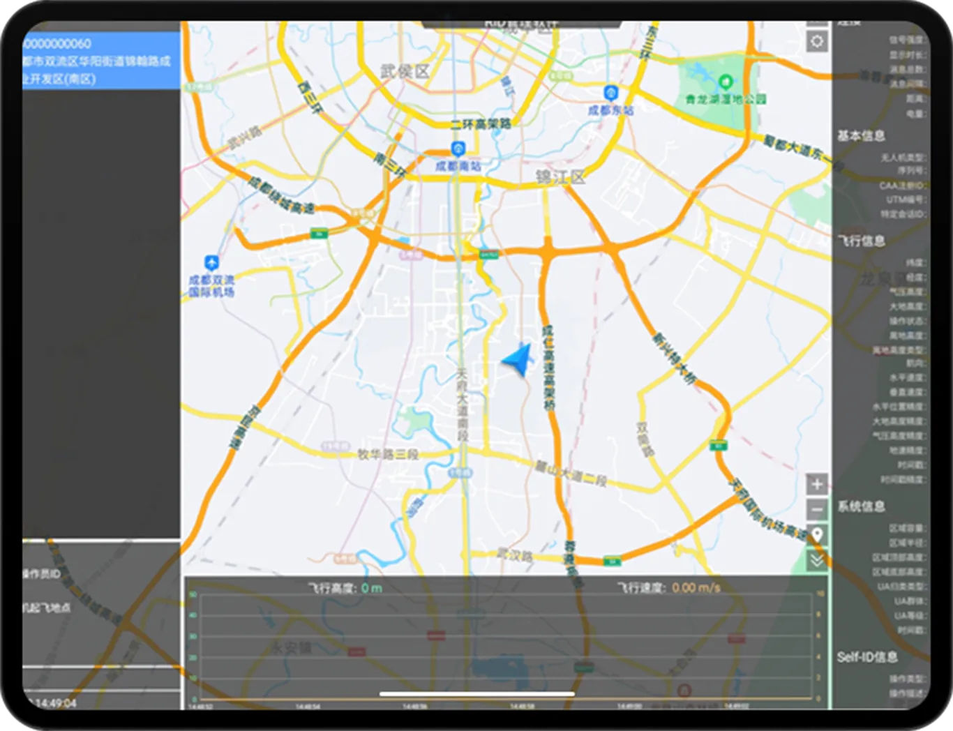
Provides real-time monitoring, tracking and reporting capabilities to ensure drone safety and compliance.

Remote identification management software (PC version)

Combining drone technology with cloud computing, a system for remote control, data storage and analysis of monitoring tasks is implemented.

Low-altitude unmanned aerial vehicle surveillance ground station

Support remote management

▪Data security

▪Support full link data reception

▪Support multiple data reporting protocols


Target customers

Organizations, agencies and departments that need to monitor airspace

Low-altitude unmanned aerial vehicle remote identification module (external)

RID-BC-002C integrates batteries, multi-mode GNSS modules, barometric altimeters, antennas and other devices, and has the ability to work independently. Unmanned aerial vehicles can be equipped with this product through bundling/brackets/sticking, etc., so that it has the ability of remote identification and meets the low-altitude unmanned aerial vehicle operation requirements in various regions.


Target customers

Micro/light/small drones

Low-altitude unmanned aerial vehicle remote identification module (external)

RID-BC-002B integrates multi-mode GNSS modules and barometric altimeters at the hardware level, and can work independently without interacting with additional sensors. It has the advantages of small size, light weight, low power consumption and built-in shielding cover. The 2.4GHz antenna interface and multi-mode GNSS antenna interface provided are convenient for integration by manufacturers of operation identification products and drone manufacturers.


Target customers

Stock drones

Low-altitude unmanned aerial vehicle remote identification module (built-in)

Multiple broadcasting methods

Broadcast channel adjustable

Support OTA upgrade and configuration

Full coverage of parameter configuration capabilities

Automatic/programmed working mode

Rich interface protocols


Target customers

Micro/light/small drones

Application Scenario
Convenient vertical take-off and landing, long-duration flight capability; modular design, easy to quickly disassemble and assemble pods, laser radar and other mission equipment;

Purchase Channels

Service Support